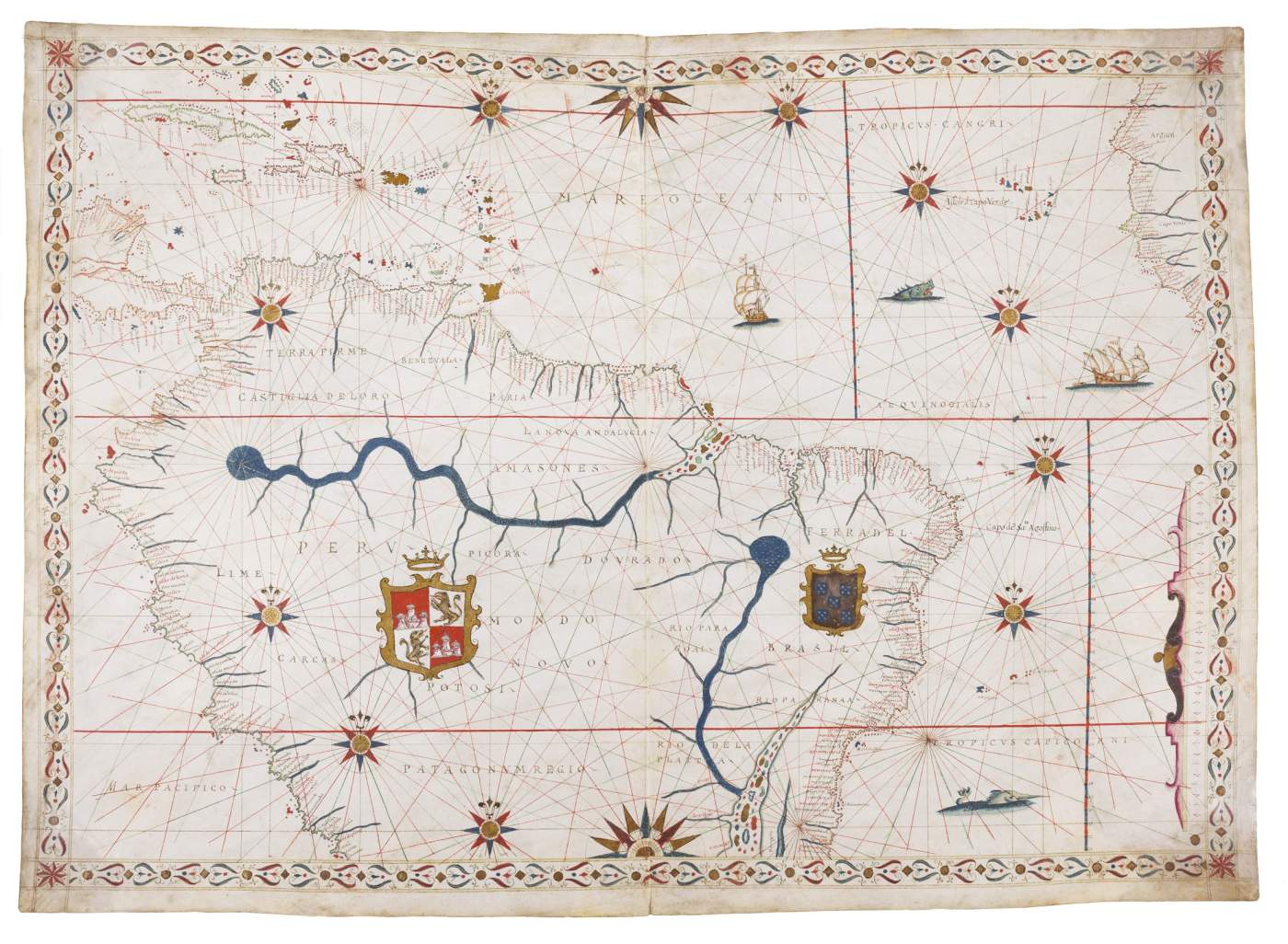

Northern part of South America
Illuminated manuscript portolan chart on vellum
by Joan Oliva
c. 525 x 740 mm
Italy, c. 1585-1595
Hide caption
The chart is oriented with North to the top and covers the western part of the South Atlantic Ocean, Caribbean Sea, eastern part of the South Pacific Ocean; Cuba, Hispaniola, Puerto Rico, other Caribbean islands; coasts of South America, southern part of the isthmus of Central America, Western tip of Africa, including Cabo Verde and the Cabo Verde Islands. The most notable features of this chart are the two main river systems Amazon and the Rio del Plata with a large tributary flowing down from northern Brazil, and their island-filled estuaries. The cartography of the coastlines of South America is consistent with the typical cartography of the late sixteenth century. Noteworthy are the two large armorial devices surrounded by gold and headed by a crown, presenting the royal coat of arms of Spain (in fact of the kings of Castile and Leon) in Peru and those of Portugal in Brazil. The seas contain sea monsters and ships under sail, one with two flags with St. Georges Cross, the other with a banner with, perpendicular, five red stripes.


